
-

-

Autodesk Navisworks
Navisworks® Simulate and Manage tools enable greater coordination, construction simulation, and whole-project analysis for integrated project review. Navisworks Manage includes advanced clash detection and interference management tools
Call for priceAutodesk Navisworks
Call for price -
 Call for price
EaseUS Data Recovery WizardPro 14.4
Call for price -
-

Grapher
Gain deeper insight into your data.
Visualize Data
Present your data at its best. Grapher offers high-quality graphing tools so you can get the most out of your data. Grapher provides over 80 different 2D and 3D graphing options to suit multiple industries, from geology and hydrology to environmental work and construction.
Grapher is a full-featured scientific graphing package, allowing the user to import data in many formats, create and combine a wide variety of 2- and 3-D plot types, and customize the plots in infinite detail.
David Suder, Principal Scientist
Precise Environmental ConsultantsCall for priceGrapher
Call for price -

Voxler
Power forward into 3D visualization
VOXLER IS RETIRED
Don’t worry! We’re still here to help.
Voxler is officially retired, but you can still purchase additional licenses. Please note, Voxler is sold as-is and will not receive updates, fixes, or new features. We will continue to provide technical support to the best of our abilities.Call for priceVoxler
Call for price -

MapViewer
Make the most of your spatial data.
MAPVIEWER HAS RETIRED
We no longer sell MapViewer, but don’t worry! The answer to your MapViewer question is a click away…
Did you know a number of MapViewer features are available in our 2D & 3D mapping, modeling, and analysis software application, Surfer? If you’re looking for outstanding interpolation methods, check out the free Surfer trial!
Call for priceMapViewer
Call for price -

Strater
Eliminate subsurface uncertainty.
STRATER IS RETIRED
Don’t worry! We’re still here to help.
Strater is officially retired, but you can still purchase additional licenses as needed. Please note, Strater is sold as-is and will not receive updates, fixes, or new features. We will continue to provide technical support to the best of our abilities.Call for priceStrater
Call for price -

Didger
Amp up your geoprocessing toolbox.
DIDGER HAS RETIRED
We no longer sell Didger, but don’t worry! The answer to your Didger question is a click away…Did you know a number of Didger features are available in our 2D & 3D mapping, modeling, and analysis software application, Surfer? If you’re looking for outstanding interpolation methods, check out the free Surfer trial!
Call for priceDidger
Call for price -
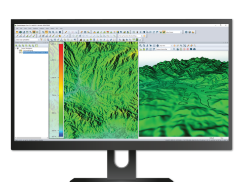
Global Mapper Pro
VERSION 24.1
The all-in-one GIS software
Established as an advanced and comprehensive geospatial software, Global Mapper Pro excels in terrain analysis, point cloud editing, drone-collected image processing, and much more. Recent versions of the program have worked to broaden this functionality to include Python programming language integration, assisted manual classification with Point Cloud Segmentation, and manual elevation grid editing with Terrain Painting. Version 24 of Global Mapper Pro continues this work by expanding workflow optimization methods, the lidar analysis toolset, and advanced analysis and data creation methods. Check out the top new and exciting features in Global Mapper v24 below.
Script Builder
Global Mapper Script, a proprietary and text-based method to automate workflows, is not new to Global Mapper. However, in Global Mapper Pro v24 a new Script Builder tool makes the creation of workflow scripts more accessible. Through this new tool Global Mapper Script commands are recorded based on tools used in the Global Mapper Pro user interface.

By recording actions taken in the Global Mapper Pro user interface, the Script Builder helps create a Global Mapper script for a workflow. Enabled from the File Menu, the Script Builder records actions and steps taken in the Global Mapper Pro user interface, transforming movements and tool setups to Global Mapper Script. Each command recorded by the builder appears as a line in the dockable tool interface and provides the user with options to edit individual parameters, or open a sequence of commands in the Script Editor for manual editing and saving.
Along with the new tool for Global Mapper Script building comes a button option to Copy Script now appearing in many analysis tool dialog boxes. This new option works separately from the Script Builder but allows users to copy the script command with parameters and values that mirror the tool setup applied in the Global Mapper Pro user interface. This new option dispersed throughout the Global Mapper Pro analysis tools again increases the ease with which users can begin using Global Mapper Script to optimize workflows.
Variography and Kriging
An advanced method for data densification and prediction, the Variography and Kriging tool in Global Mapper Pro v24 is opened from the Analysis Menu. Consisting of multiple dockable windows, the Variography and Kriging tool first displays an empirical variogram for the input vector point or point cloud data, allowing the user to select the input attribute used in the analysis as well as granting full control over the variogram plot through the tool settings. After plotting the calculated variance throughout the dataset, a variogram map and associated values can be displayed and explored.

The Variography and Kriging tool in Global Mapper Pro accepts point cloud or vector point data as an input. Moving toward the kriging process and data creation, a number of theoretical models are then fitted to the data-driven empirical variogram plot, and users can compare the calculated values and formulas to determine the best fitting theoretical model to use in generating krige estimates. Using the selected theoretical data model, derived from the input data variance, a kriged prediction layer is created in the workspace containing the estimates alongside an uncertainty measure for each point. With the output layers generated, the estimated values, referred to as generic values, and uncertainty can be visualized through the use of specialized Lidar Daw Modes.

The kriged estimates are generated as a point cloud with options to generate a gridded layer and mesh. Mobile Data Merging
While Global Mapper Pro is a powerful application, it is an installed program designed to run on a desktop or laptop machine that provides the necessary processing power for advanced operations. To use and collect data in the field, Blue Marble produces Global Mapper Mobile, a mobile app available on Android and iOS, as part of the Global Mapper Suite of programs. In a previous release of Global Mapper, a new Mobile Data Management tool took great strides in streamlining the integration between Global Mapper desktop and Global Mapper Mobile with support for wireless data package transfer. Global Mapper Pro v24 takes this tool even further, introducing a data merging component that assists users in combining collected data from multiple Global Mapper Mobile Package (*.gmmp) files.
Designed as a data merging tool, the Package File Import tab of the Mobile Data Management tool in Global Mapper Pro prompts the user for two files, one to pull data from and the other to merge data to. With the files selected, a table view shows users the differences between the designated FROM and TO files tracked by unique GMMID values generated in saved package files from Global Mapper v24 and the latest version of Global Mapper Mobile.

A new Package File Import tab in the Mobile Data Management tool allows users to more easily merge data from two different package files. Clearly marked by icons in the list of data items, users are able to make decisions about differences between the TO and FROM files marking what entries to keep and discard from each input package file. With all differences resolved, the data can be merged and exported to Global Mapper Mobile Package (*.gmmp) format before being loaded into the open workspace.
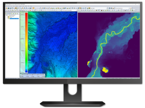
Swath Separation Image Creation
Adding to the set of lidar analysis tools available in Global Mapper Pro v24 is Swath Separation Image creation. A functionality requested by users of Global Mapper Pro, the Swath Separation Image tool is found on the Lidar Toolbar and generates an image of a point cloud showing the vertical separation between overlapping collection swaths or layers. The generated image depicts the intensity value of the point cloud and shades overlap areas with specific colors to display separation at designated vertical offset thresholds.

A swath separation image is created in Global Mapper Pro from layers of lidar data. A simple to execute tool, Swath Separation Image creation in Global Mapper Pro v24 aligns with the USGS base lidar specification and automatically exports the generated image to GeoTIFF (*.tif), JPG (*.jpg), JPG2000 (*.jp2), ECW (*.ecw), or PNG (*.png) format at a user-specified location. The saved file is then automatically loaded into the Global Mapper workspace allowing the swath separation to be explored for data quality assurance purposes.

The generated swath separation image uses designated colors to show the vertical offset between lidar swaths. Providing users at all skill levels with advanced tools, Global Mapper Pro continues to be an affordable all-in-one GIS software solution. As a program used throughout many industries, the new tools available in version 24 are sure to increase the indispensability of Global Mapper Pro as a tool for teams worldwide.
Call for priceGlobal Mapper Pro
Call for price -
Global Mapper
Related Blogs for Global Mapper
Trusted by GIS professionals around the world.
Global Mapper® is a cutting-edge GIS software that provides both novice and experienced geospatial professionals with a comprehensive array of spatial data processing tools, with access to an unparalleled variety of data formats.
Global Mapper’s intuitive user interface and logical layout help smooth the learning curve and ensure that users will be up-and-running in no time. Organizations of any size quickly see a significant return on investment brought about by efficient data processing, accurate map creation, and optimized spatial data management.
Developed for both GIS professionals and map enthusiasts, Global Mapper® has all the functionality you need in a GIS software:
Call for priceGlobal Mapper
Call for price