Global Mapper Mobile


Call for price
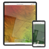
Global Mapper Mobile® is a powerful iOS and Android application for viewing and collecting GIS data. It utilizes the GPS capabilities of mobile devices to provide situational awareness and locational intelligence for remote mapping projects. A perfect complement to the desktop version of Global Mapper, the mobile edition provides maps-in-hand functionality for engineers, surveyors, wildlife managers, foresters, and anyone whose job requires access to spatial data in remote locations.
Global Mapper Mobile® is a powerful iOS and Android application for viewing and collecting GIS data. It utilizes the GPS capabilities of mobile devices to provide situational awareness and locational intelligence for remote mapping projects. A perfect complement to the desktop version of Global Mapper, the mobile edition provides maps-in-hand functionality for engineers, surveyors, wildlife managers, foresters, and anyone whose job requires access to spatial data in remote locations.
Global Mapper Mobile can display vector, raster, and elevation data layers that have been transferred from the desktop version of the software. It also provides tools for drawing, tracking, and form-based data collection using pre-configured attributes and picklists.
Global Mapper Mobile Base Version (Free of charge)
The base version of Global Mapper Mobile is free of charge and provides an array of features and functions, including:
- The ability to take and save multiple pictures associated with a given feature. – New in v2.3
- When creating a feature, a voice memo can be recorded and associated with the feature. – New in v2.3
- Option to create automatic backups while in the field. – New in v2.3
- Expanded built-in supported vector styles and custom symbols
- Terrain layer support offering hill shading, terrain shader display as Atlas shader, and the ability to view elevation at a specific location
- Improved layer transparency setting with a color picker and support for Dark Mode
- Field access to all GIS data
- GPS-based field data collection
- Digitizing or drawing tools
- Feature attribute management
- Simple and efficient data deployment and return
- Self-contained map storage and display – No data connection required
- Picture point creation from geotagged photos
- Online access to OpenStreetMap Data
Global Mapper Mobile Pro
Developed with today’s mapping professionals in mind, the Pro version of Global Mapper Mobile supplements the functionality of the base version with an array of professional-grade tools including:
- Connect to any GNSS device which supports communication over TCP/IP – New in v2.3
- Users now have the ability to calculate volume from a preloaded area feature or from an area feature created in the field. – New in v2.3
- Calculate a view shed from point features recorded in the field. – New in v2.3
- Newly added native support for UTM and SPCS-based projections. – New in v2.3
- Advanced GPS support to connect to external high accuracy Bluetooth GPS devices from vendors such as Bad Elf and EOS, among others.
- Terrain shader selection/change within the app
- Enable water level display on terrain data
- Extensive preconfigured and customizable online data services
- The option to save this streamed data for offline use
- Support for GeoPackage and GeoPDF files
- Advanced projection support
- Support for external GPS receivers
- GPS averaging
- Display of distance and bearing to a location
- Terrain shader options
Reviews
There are no reviews yet.