
-
3ds Max
Take full artistic control with professional-quality 3D models
Create massive worlds in games, stunning scenes for design visualization, and engaging virtual reality experiences. Use 3ds Max® toolsets to shape and define detailed environments, objects, and characters. Model any person, place, or thing.Call for price3ds Max
Call for price -

-
Architecture, Engineering & Construction Collections
Accelerate design processes and improve quality with integrated workflows for document management, conceptual design, modeling, coordination, and documentation.
Call for priceArchitecture, Engineering & Construction Collections
Call for price -
Autodesk Autocad 2022-Subscription License
AutoCAD® is computer-aided design (CAD) software that architects, engineers, and construction professionals rely on to create precise 2D and 3D drawings.
Call for priceAutodesk Autocad 2022-Subscription License
Call for price -
Autodesk Navisworks
Navisworks® Simulate and Manage tools enable greater coordination, construction simulation, and whole-project analysis for integrated project review. Navisworks Manage includes advanced clash detection and interference management tools
Call for priceAutodesk Navisworks
Call for price -

Didger
Amp up your geoprocessing toolbox.
DIDGER HAS RETIRED
We no longer sell Didger, but don’t worry! The answer to your Didger question is a click away…Did you know a number of Didger features are available in our 2D & 3D mapping, modeling, and analysis software application, Surfer? If you’re looking for outstanding interpolation methods, check out the free Surfer trial!
Call for priceDidger
Call for price -
-
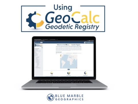
GeoCalc SDK
The GeoCalc Software Development Kit® (SDK) is a fully object-oriented class library designed for GIS professionals and software developers.
Call for priceGeoCalc SDK
Call for price -
GeoCore SDK
GeoCore®: The All-in-One Geospatial Data Conversion API
Call for priceGeoCore SDK
Call for price -
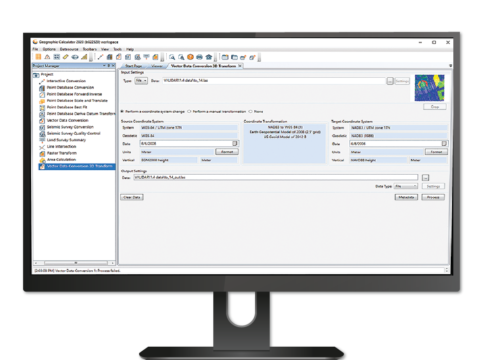
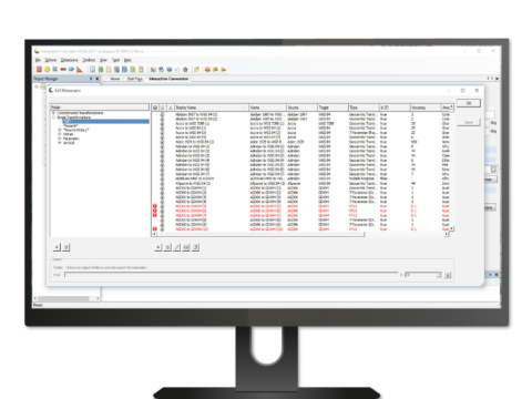
Geographic Calculator 2023
Geomatic Calculation & Transformation
Geographic Calculator® is a powerful geodetic software for accurate coordinate conversion, datum transformation, and file translation. Built on the foundation of the largest geodetic parameter database available anywhere, it has particular strength in the fields of surveying, seismic data management, and energy exploration.
Call for priceGeographic Calculator 2023
Call for price -
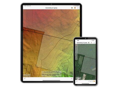
Global Mapper Mobile
Global Mapper Mobile® is a powerful iOS and Android application for viewing and collecting GIS data. It utilizes the GPS capabilities of mobile devices to provide situational awareness and locational intelligence for remote mapping projects. A perfect complement to the desktop version of Global Mapper, the mobile edition provides maps-in-hand functionality for engineers, surveyors, wildlife managers, foresters, and anyone whose job requires access to spatial data in remote locations.
Call for priceGlobal Mapper Mobile
Call for price